
L1 GNSS RTK Receiver
L1 GNSS RTK Receiver
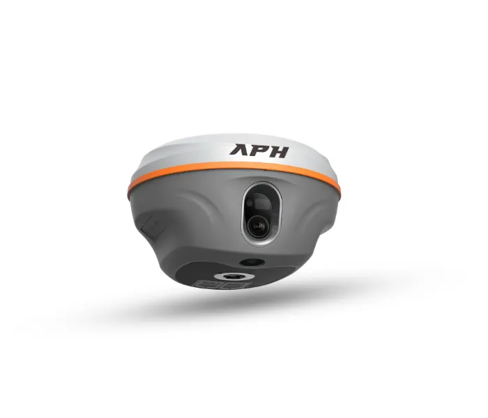
L1 GNSS RTK Receiver
Precision Without Compromise
Deliver exceptional survey accuracy with the L1 GNSS RTK Receiver, engineered with advanced GNSS technology, laser surveying, dual HD cameras, and AR stakeout capabilities. Designed to help professionals complete projects faster, smarter, and with confidence.
Product Overview
Advanced GNSS Survey Solution
The L1 GNSS RTK Receiver is a next-generation surveying solution developed for surveyors, civil engineers, GIS professionals, construction teams, and mapping experts. Combining multi-constellation GNSS tracking, laser measurement, AR stakeout, and intelligent tilt compensation, the L1 delivers unmatched precision and productivity across every surveying application.
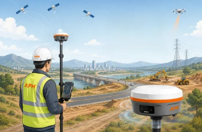
Key Features
Multi-Constellation GNSS Tracking
Track multiple satellite constellations simultaneously for reliable positioning and higher accuracy in challenging environments.
Dual HD Cameras with AR Stakeout
Integrated dual high-definition cameras provide an enhanced augmented reality stakeout experience, improving field efficiency and reducing setup time.
Laser Survey up to 30 m
Perform accurate non-contact measurements up to 30 meters, making difficult or inaccessible survey points easier to capture.
IMU Tilt Survey up to 120°
Measure accurately without keeping the survey pole perfectly vertical. Advanced IMU technology supports tilt surveying up to 120°.
Built-in 4G, Wi-Fi & Bluetooth
Stay connected in the field with seamless wireless communication and fast data transfer.
Long-lasting 20-Hour Battery
High-capacity battery delivers reliable all-day performance, minimizing downtime during extended field operations.
IP67 Waterproof & Dustproof
Built to withstand harsh environments with superior protection against dust, water, and challenging weather conditions.
Lightweight & Rugged Design
Compact and durable construction offers excellent portability without compromising performance.
Technical Highlights
| Feature | Details |
|---|---|
| GNSS Tracking | Multi-Constellation |
| Cameras | Dual HD Cameras |
| AR Stakeout | Supported |
| Laser Survey | Up to 30 m |
| Tilt Compensation | IMU up to 120° |
| Connectivity | 4G, Wi-Fi & Bluetooth |
| Battery Backup | Up to 20 Hours |
| Protection | IP67 Waterproof & Dustproof |
| Design | Lightweight & Rugged |
Applications

Land Surveying
Accurate measurements for boundary and topographic surveys.

Construction Layout
Precise positioning for construction planning and execution.

Road & Highway Projects
Reliable surveying for roads, highways, and transportation projects.

GIS Mapping
High-precision data collection for GIS and mapping applications.

Utility Survey
Efficient mapping of underground and above-ground utilities.

Agriculture
Supports precision farming and efficient land management.

Infrastructure Development
Ideal for surveying large-scale infrastructure and urban projects.
Why us? ?
Why Choose L1 GNSS RTK Receiver?
- High-precision GNSS positioning
- Integrated laser surveying technology
- Advanced AR stakeout with dual HD cameras
- Faster and more efficient field workflows
- Lightweight yet rugged construction
- Reliable wireless connectivity
- All-day battery performance
- Built for demanding outdoor environments
- Trusted by professional surveyors and engineers
Contact US
Experience Precision Without
Compromise
Take your surveying projects to the next level with the L1 GNSS RTK Receiver. Built for professionals who demand exceptional accuracy, intelligent features, and dependable performance in every environment.
FAQ
Frequently Asked Questions?
What makes the L1 different from a standard GNSS receiver?
The L1 combines GNSS positioning, laser surveying, AR stakeout, and dual HD cameras into one powerful surveying solution.
Does the L1 support tilt surveying?
Yes. It supports IMU tilt compensation up to 120°.
How far can the laser survey measure?
The integrated laser system supports measurements up to 30 meters.
What is the battery backup?
The L1 offers up to 20 hours of continuous operation.
Is the receiver suitable for harsh outdoor environments?
Yes. It features an IP67 waterproof and dustproof design for reliable field performance.